MAPS AND AERIALS OF ATLANTA AIRPORT FROM 1972
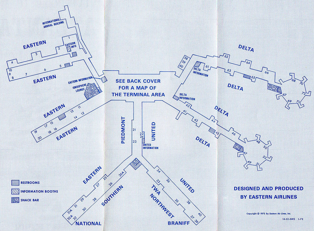
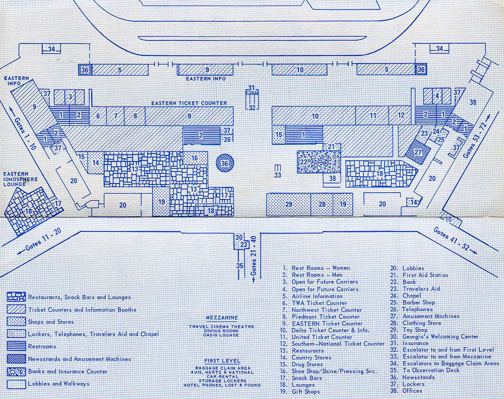
This two-sided map of Atlanta airport was published by Eastern Airlines in 1972. By this time, the area at each end of the main lobby had been expanded to directly connect to the concourses on either side and provide space for additional ticket counters. Thanks to Robert Brown for sending this in!
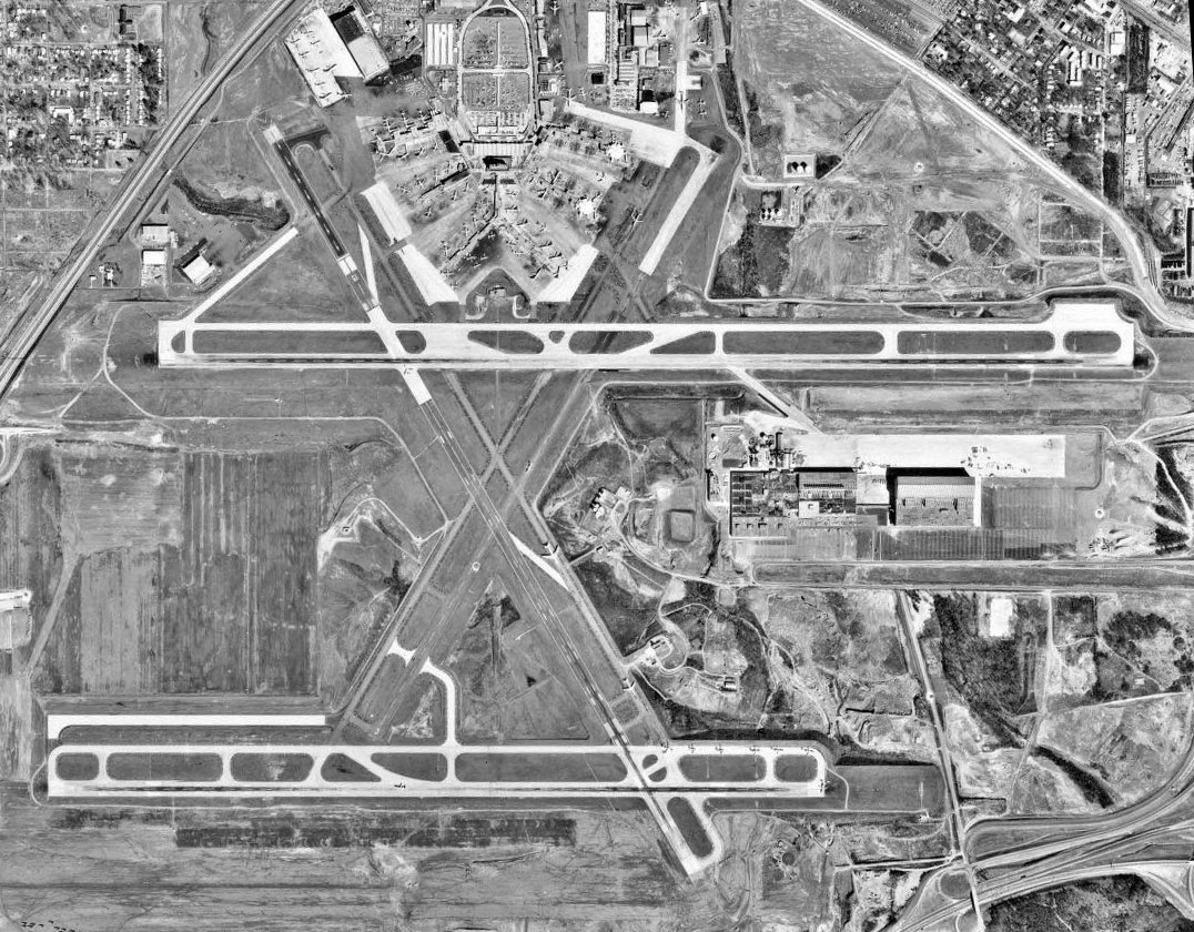
Aerial photo of Atlanta airport from 1972
In 1972 Atlanta Airport had four active runways, two parallel east-west runways (9L-27R and 9R-27L which are now known as 8R-26L and 9L-27R respectively) and two diagonal crosswind runways (15-33 and 3-21) that would soon be closed for the construction of the midfield terminal. There is an incredible amount of construction activity in this photo. At top right, an entire neighborhood had been cleared to make way for a large new cargo building. The partially completed loop road borders the construction area. Across the bottom of the photo, crews were busy grading a nearly 2 mile stretch that would become the site of the third parallel runway. At far left, hundreds of houses had been cleared for what would become the massive midfield terminal which is still in use. Courtesy of the Georgia Aerial Photograph database.
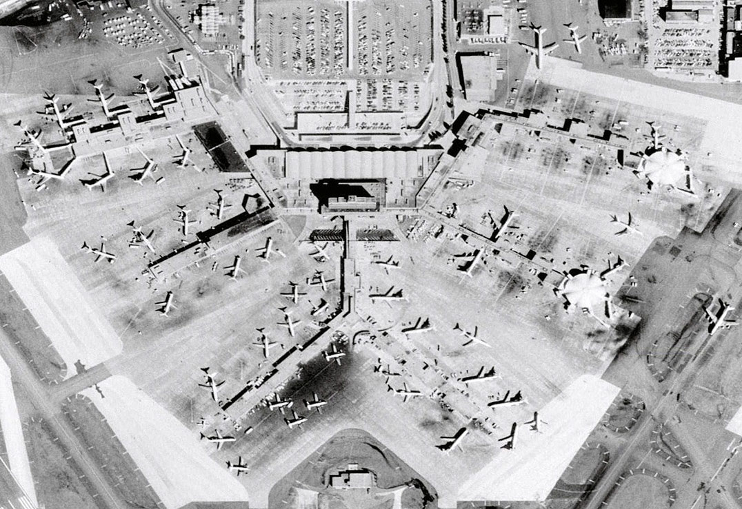
Here's a close-up of the terminal from the same photo showing the extremely crowded conditions. Left to right are concourses A through F.


